
Soil Surveying & Mapping
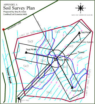 Sample of a soil survey map
I offer cost-effective, detailed soil mapping for site development and environmental permits. A soil map is developed to address specific land use and management goals. The maps provide detailed information for land uses such as building construction, erosion/sedimentation control planning, storm water design, natural resource protection, and others In addition to a high quality soil map, you will receive a report containing soil pit logs and descriptions of soil map units which explain specific soil properties and limitations in relationship to the project and its goals.
Soil surveys are completed using the 'Guidelines for Maine Soil Scientists for Soil Identification and Mapping' as well as the Keys to Soil Taxonomy and other publications for the National Cooperative Soil Survey produced by the USDA's Natural Resources Conservation Service.
What is involved in Soil Mapping
Soils differ from place to place in both physical and chemical processes. As a result, different soil types support different land uses so state or local governments may require a soils map and soils information for a given property depending on its intended land use.
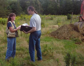 Discussing site suitability survey with client
While on the property, I will investigate indicators of soil type such as color, texture and evidence of a seasonal high water table using hand tools and/or a small excavator; landscape position, rock formations and vegetation give further information as to soil type. Both a county soil survey, generated by the United States Department of Agriculture Natural Resources Conservation Service (NRCS) and a topographical map provided by a licensed land surveyor are then referenced to help define soil type boundaries. Soil types or soil series are determined for the investigated area, providing information regarding slope of the land, drainage class, depth of seasonal high water table, etc. A soil map is then generated using CAD or GIS, along with a descriptive report of how the soil types affect the plans for the property.